Author: Harold

  • D3 – Seven Mile Bridge

    D3 – Seven Mile Bridge

    Monday, December 1st, 2025. Bahia Honda State Park Campground, site 13. Off m37.9 of the Overseas Heritage Trail. 75°, occasional breeze. 24.657882,-81.278230

    I woke up about fifty times throughout the night. The temperature did eventually drop. A little wind did pick up, but it was a sticky mess inside my tent all night long. Uncomfortable. Bit up by bugs.

    The moon was out most of the night. It rained for a few minutes just as it went down. I convinced myself to get up and pack up sometime after 6 am. With all my gear in order, I walked back over to the shower house to take another shower.

    Yesterday, I washed my underwear and shirt in the shower. I put them on wet this morning, but it wasn’t bad at all. I eat a little breakfast and try do a good job with all the chores and stuff. Walking out from the state park a little before 730.

    Wet underwear, high humidity, terrible red skin in my groin. Still hopeful there will somehow be no more additional painful chafing today. Lol.

    Beautiful morning at Bahia Honda State Park Campground.

    It’s going to be a challenging day today. I really need to move and find distance. I need to try not to stop for too much food. Lol.

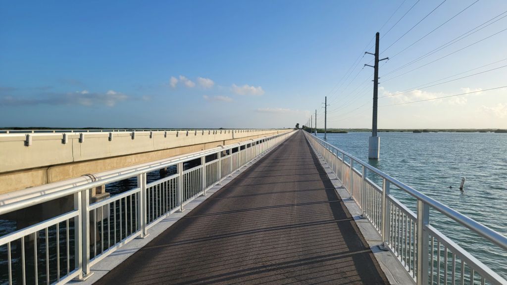
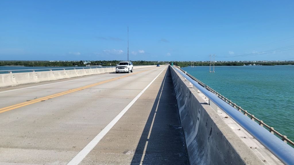
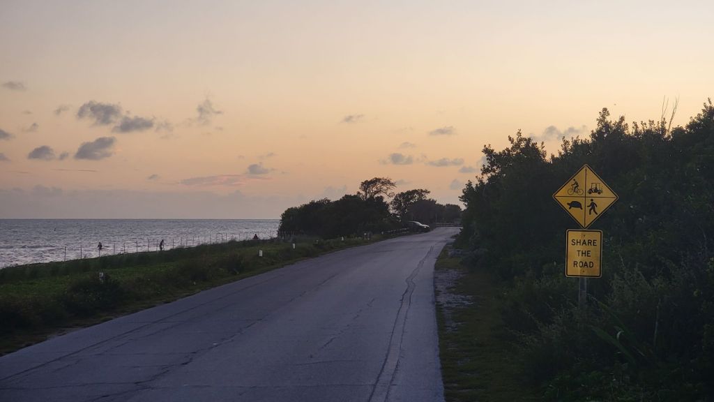
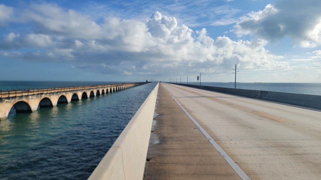
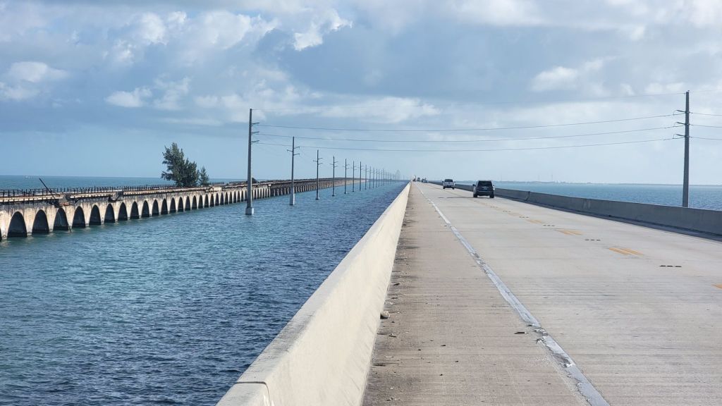
    Most notable of the day’s obstacles, the Seven Mile Bridge. A trail famous feature. It comes on quickly departing the Bahia Honda State Park.

    Beginning of the Seven Mile Bridge. Looks peaceful, doesn’t it? Ha!

    Walking into traffic gives the larger of the two bike lanes. Research on this situation says the worst part isn’t repeat impending death by oncoming traffic. It’s the inability to go to the bathroom.

    Fred the tree.

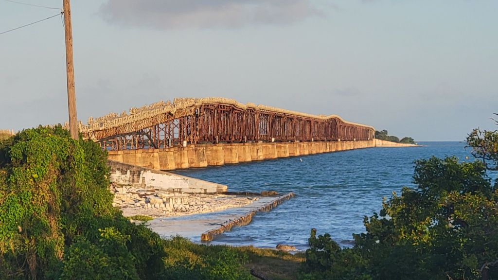
    Fred The Tree is an actual Florida thing. There’s no way to get to Fred. Even with a boat, you’d need a landing party with a grappling hook and ladder.

    For me, the biggest issue over the Seven Mile Bridge was the fear of falling over the barrier and into the water. Seems possible and is absolutely inadvisable. I’m not a fan of the water or falling off bridges. Confirmed.

    I make it off the bridge by 10:45am. A handful of vehicles came over the white line at me, but it wasn’t that bad. I even managed to figure out how to urinate, very relieving.

    To celebrate not dying on the bridge, I go into the Seven Mile Grill. “We make our own sausage!” Oh well, omelet then, please. Rye toast, home fries. Good times. It was okay.

    There is a Starbucks a couple doors north of the diner. I want a latte until they tell me it’s more than $11! Wow. Yeah, no. Regular coffee, please. Out from Starbucks, 12:15pm. I live an amazing life.

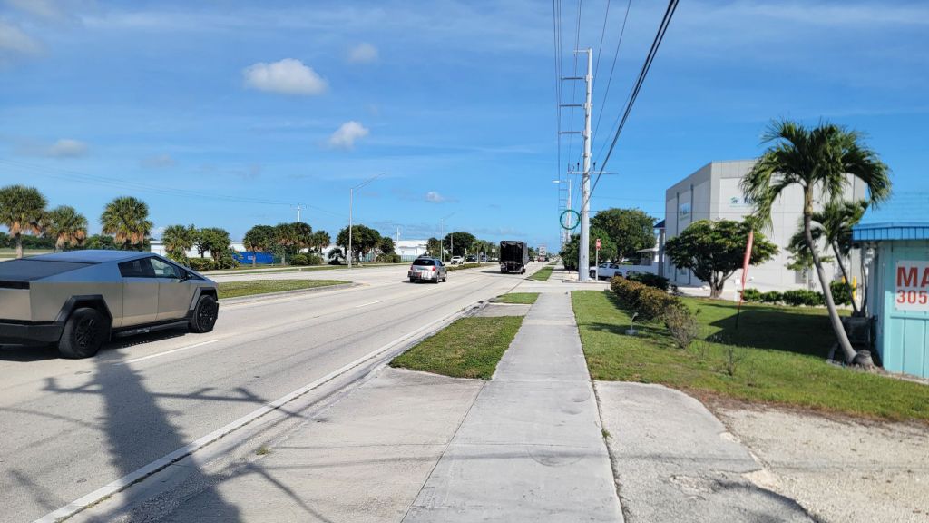
    Working my way across Marathon Key and it’s hot! 77° is what the weather says. In the sun, on the sidewalk, keeping an eye on cars that might run into me, the temperature feels a lot hotter. At 1pm, I stop in to Publix for bathroom and water. That means I’ve had 2l since Starbucks, one hour ago.

    On trail neighbor.
    Marathon Key is a busy urban place along A1A.
    The older bridges that are crumbling have railway, and this explains that. Railway to Key West until hurricane in the 30s. So, those bridges are OLD!
    A bit of shade and distance from the road, north  of Marathon center.

    Just before the sun goes down, I stop for a bacon cheeseburger at S.S. Wreck & Galley Grill. It was okay. Maybe. Sigh. I gotta stop stopping at these key restaurants, expensive and mediocre! I am carrying more than enough food for me on my back! I don’t have anywhere near enough money to eat like this, lol. Cheeseburgers are my siren song. Nightmare!

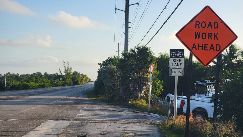
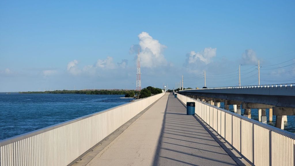
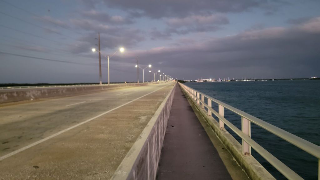
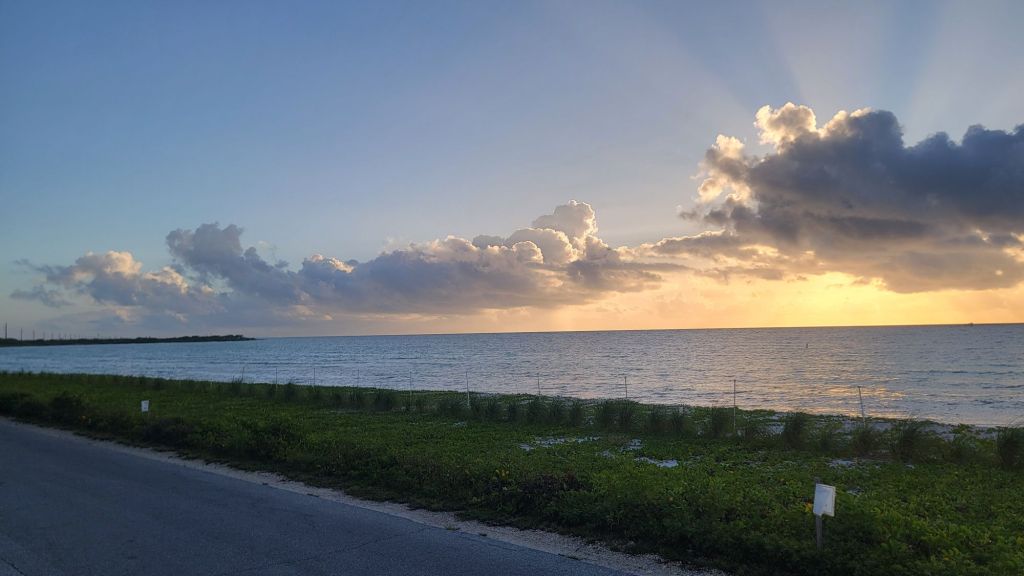
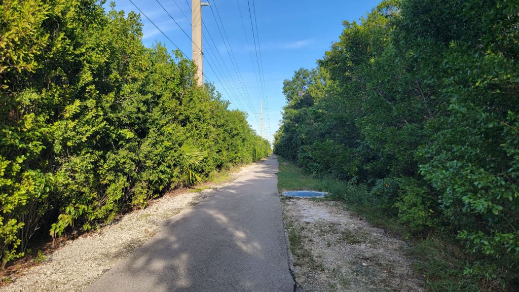
    By 630pm, less than a mile after the restaurant, the trail offers me a protected bike lane. It is completely dark as I get ready to pass Duck Key. The moon is out. The temperature is fantastic, the no-see-ums are not horrible, and the wind is below moderate. NIGHT WALKING! LET’S GO!

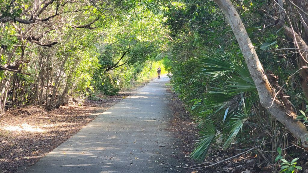
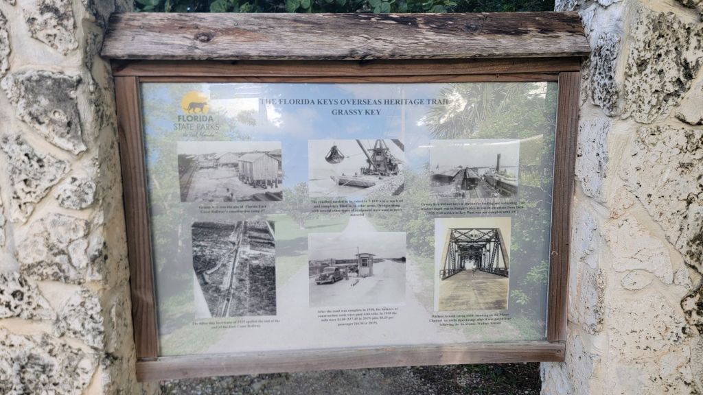
    The trail from Conch Key to Long Key was fantastic; the old roadway converted to bike path. The breeze is up, the moon is bright, and there are people fishing in the dark.

    I take an excessively long break at the Long Key parking lot, where there is a semicovered park bench that I try really hard to talk myself into cowboying on. The breeze would have been lovely but very close to the road, and so I decided to move on.

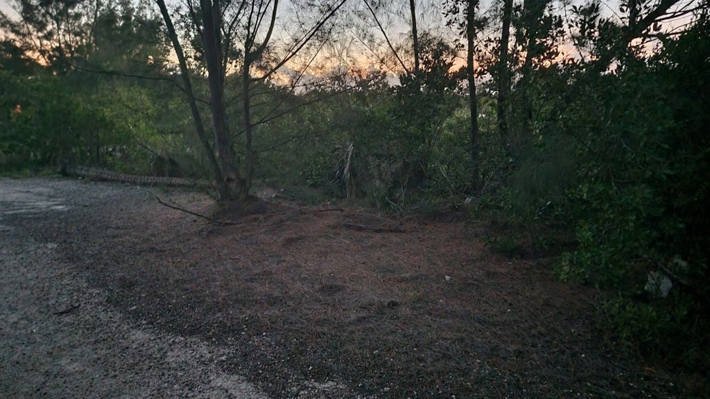
    I make for the Layton Trail, a quarter-mile nature trail out to a “viewpoint” on Florida Bay. To me, a viewpoint is an elevated situation. In this case, viewpoint is a break in the dense plant matter where there’s water. Between the road and the water, I find an open enough spot in the jungle leaves to set my tent. Miserable.

    At 1030pm, I am on the ground, in my tent, in one of the most humid, stale air spots I’ve ever camped in in my life. Lol, hell. I probably should have cowboy’d at the parking lot. Sleeping will be difficult, and I’ll probably get eaten by a centipede.

    It’s been a great day. I probably shouldn’t have gotten the omelet and cheeseburger, but I did. I really need sleep. I’m low on water, but there is a convenience store fairly close to here that opens at six.

    Milage:

    I started today at m39.7, and am now camped at m69.1. So, that’s a 29.4 for the day. Seems about right to me.

  • D2 – Coffee con leche and trail-side diarrhea

    D2 – Coffee con leche and trail-side diarrhea

    Sunday, November 30th, 2025. Tented south of Overseas Heritage Trail m11.3. Across the street from the Monroe County Fire Rescue Station 9. Google Maps had it as Porpoise Boulevard. Old asphalt covered in organic debris. 24.597448,-81.654341

    Wind and a little rain overnight but minimal. Woke naturally to the sound of wild roosters doing their thing at about 6 am. Toss and turn all night, but I do think I got some sleep. Very humid and sticky.

    Slept here. A car passed me in the night coming into this area, which was highly suspect. The car did not exit. Eventually, I went back to sleep. In the morning, I see they are car camped 100 yards away.
    Post coffee photo of path into last night’s campsite. I wonder if I would have checked it out if I didn’t see it on FarOut.

    At Around The Bend Hostel, I was talking with another hiker about morning routines. I had said that making coffee, packing up, and two poops and all that, it took me an hour and a half. I told the hiker this frustrated me and that I called it a 90-minute morning

    Today, I am sitting in a Cuban like coffee shop at 635am. Walked south about half a mile to Big Coppitt Coffee. They have steamed milk and coffee in a styrofoam cup. Just like Puerto Rico.

    When the bike lane ends, it’s time to walk with traffic. Perfectly normal.

    Reading the map, it seems like the thing to do is make a tenting reservation at Bahia Honda State Park. After fees and everything, $49. I feel it is expensive and am a little frustrated with myself. Wouldn’t it be better if I just stealth on the side of A1A? Lol, probably not. It’s gonna be a great day. I wish I could speak Spanish. I wish I could drink another coffee, but it’s definitely time to go. Out the door of the coffee place, 720 am.

    I stopped at Baby’s Coffee. Cuban sandwich, key lime pastry, another coffee con lache, and some electricity. Oh, man, do I love food and coffee. Delightful. Out at 930am.

    So far, much of the bike lanes – what looks to be the original highway – have been open and in pretty new condition.

    Somewhere on Summerland Key, I have explosive diarrhea. The first LNT violation of this trip. Perhaps Jamaican revenge, who knows.

    Some of the path is away from the road and under the shade of trees. Some as in less than 5%, but still, very nice.

    It’s hot, and I stop several times to rest. I have the feels in various body parts, notable my left knew, this is unusual.

    Much of the on-road walking is causeway, and mostly, there is plenty of room to walk. I give it sketchy road walk 1 of 5.

    My food bag is heavy. Not helped by all the restaurants along this roadwalk. At 330pm, I stopped at Pop’s Smoke Shed – Big Pine Key, hoping for BBQ but getting a Cuban. The waitress is over the top, either she thinks I’m a retard or she’s an alcoholic. Food was not great. I told her it was. Gross.

    Section of trail that is far from the road on its own bridge. Often, there are people fishing. I even saw a woman land a fish today. It was pretty small, but still, pretty cool.

    In the afternoon, I start having hiker related body problems. Lol. I did a reasonable amount of work before coming out here, a thousand miles in Ohio, but still, I’ve got the problems.

    For one, and not really that funny, I have obvious hotspots and blisters growing on both feet. Good times.

    The old bridge – and long unused – onto Bahia Honda. This bridge and many others are actually falling apart, large pieces of concrete and iron falling into the water.

    For two, and definitely funny, I used an electric hair trimmer to cut the hair on my head and face down to the shortest level possible before checking into Around the Bend Hostel. That’s how I feel the most comfortable, with very short hair on my head and face.

    Walking the last section of causeway into Bahia Honda State Park as the sun goes down. The shoreline there is the park. It’s a pretty nice place.

    The funny part is that I’m an idiot and for some reason, I decided to keep using the trimmer with its shortest possible setting on my pubic hair. If you don’t know, pubic hair helps lower skin on skin resistance of activities like walking. Less hair means more resistance, and now I have a terrible rash in my groin, and it’s very painful. Lol, hell.

    After the front entrance gate, before the campground gate, in Bahia Honda State Park. Let it be known that I do yield for turtles because they’re dinosaurs.

    I get into the state park just as the sun is going down. The first thing I find is the bathhouse, and I’m thrilled. I washed my underwear and shirt in the shower and did my best to clean the areas that have been experiencing high resistance friction all day.

    The moon is out, and I set my tent up by moonlight. It’s quite beautiful, although there are a lot of mosquitoes out and I get ate up. Lol.

    It’s hot, relatively, and I’m a sweaty mess in my tent. I roll up both rain shell doors to my tent to try and get some circulation in this thing as I write this update.

    Another fantastic day, I’m thrilled.

    Milage:

    I woke up at m11.3, and the state park is m37.9, so that gives me a 26.6 for the day. Good times. Probably there’s some worthy extra distance there going back for coffee this morning and trying to get into the state park this evening, but I’ll just call it 26.6 miles.

    So thankful. A great day

  • D1 – Georgia to Overseas Heritage Trail Southern Terminus

    D1 – Georgia to Overseas Heritage Trail Southern Terminus

    Saturday, November 29th, 2025. Stanimals Around the Bend Hostel. Hiawassee, Georgia. Wake via alarm at 3:55am.

    I’m not sure how many pieces of “day one” writing I’ve done in the past five plus years, but quite a few, and here I go trying again.

    You’re reading what wants to be a hiking blog. The first thing to know is that making it to the start of a hike is one of the more difficult parts of the adventure.

    Thanksgiving day. Information board at the top of Brasstown Bald describing visible points on the Appalachian Trail.

    After feasting at the hot bar of an Atlanta Whole Foods for Thanksgiving, I drove north for the short adventure up Brasstown Bald overlooking the Appalachian Trail.

    Thursday night, I slept in the parking lot of the Hiawassee grocery store, and Friday afternoon, I drove the short distance up to Around the Bend Hostel.

    I woke just before 4 a.m., and before I could turn my alarm off, I smelled coffee. That’s friendly service.

    Around the Bend Hostel drove me two hours to the Atlanta airport but dropped me off at the wrong terminal. I didn’t know there was an airport where the international terminal was a 10-minute bus ride from the domestic terminal, but now I do. It all works out.

    I’m sitting in 28E of my first Spirit flight to Fort Lauderdale. I’ll take a second flight to Key West.

    The adventure I’m attempting has a simple tagline. Over the next year, I’ll be attempting to walk from “Key West to Canada and Back” via the Appalachian Trail.

    It’s about 8,500 miles, and I have to survive these two flights with my backpack intact to begin.

    1. Florida Keys Overseas Heritage Trail, 108 miles
    2. Eastern Continental/Florida Trail Connecter, 92 miles
    3. Florida Trail to Deer Lake Junction, 1,055 miles
    4. Blackwater Connecter, 45 miles
    5. Alabama Roadwalk, 200 miles
    6. Pinhoti Trail, 350 miles
    7. Benton MacKaye, 72 miles
    8. Appalachian Trail, 2,200 miles
    9. International Appalachian Trail to Canada, 138 miles

    I have flown with my backpack a few times, and while nothing catastrophic has ever happened, the stress of that possibility has always loomed heavy over the experience. Checking my backpack is a terrible feeling.

    I tried a different approach on this flight. I put my backpack inside a large laundry bag. It either works or I’m a very sad person.

    My first flight, from Atlanta to Ft Lauderdale, was completely full. The flight was late, and passengers started disembarking at the time my flight to Key West was to begin boarding. Something of a run across the airport, I make the flight. I asked the reps at the gate if they thought my luggage would make it, and they said, “Oh, yes, of course.” Good times.

    The second flight was basically empty, a pleasant surprise.

    An empty flight is a definite rarity. Aircraft announcement says just a 39-minute trip.
    Navel Air Station on Boca Chica Key, trail miles 8-9 down there somewhere.

    The flight was quick. I waited for my backpack longer than the flight, I think. I was thrilled not to get a cocktail at the First Call Beach Bar at the baggage claim. Mt backpack arrived safely, laundry bag idea is definitely worth repeating in the future.

    It takes a good bit of time to unpack my pack. Get myself situated, drain water from the can of green olives I brought and add water to my water bottles. Attempting to walk out of airport at about 2:15pm. Thrilled.

    I’m not a big fan of sea life, which perhaps is turning my nose up at 70% of the earth, but so be it. This sign, however, gets a thumbs up from me. I don’t stop for manatees, but I did stop to take this picture.

    I reached the southern terminus at the southern most point at about 3:15pm, and of course, it’s closed for construction, a hilarious and hopefully not ominous sign.

    Southern most under construction point. Lol.

    Walking 100 feet north to this bar front replica, I got a German tourist to take a photo.

    Looking frumpy. Lol.

    At about 5 p.m., I stopped at the One Love Food Truck for jeek chicken. It was delicious. The ginger tea was a perfect match.

    Sun goes away pretty much immediately after dinner. Passing the naval station in the dark. Two sessions of rain, both very brief and not very serious.

    A brief moment without traffic on A1A.

    As recommended to me by FarOut, there is a cowboy on Big Coppit Key across the street from the Monroe County Fire Rescue Station 9. Google Maps calls it Porpoise Boulevard, but it’s really just a place where meth heads dump house remodeling trash in the middle of the night, preferably not tonight.

    Difficult time setting up, the ground is debris covered asphalt for the most part. I use chunks of concrete to weigh down the corners of my tent. Hopefully, it will be fine.

    Inside the tent, it’s immediately very hot and very humid. Uncomfortable. Lol. Down on the ground at 8pm.

    What a fantastic day!

    Milage:

    0 – Saturday, November 29th, 2025 – 3 miles walking from Key West airport to the southern terminus (southern most point monument). Tented just south of m11.3. Call it 14.3 miles.